
Overlay Zoning
How It Works
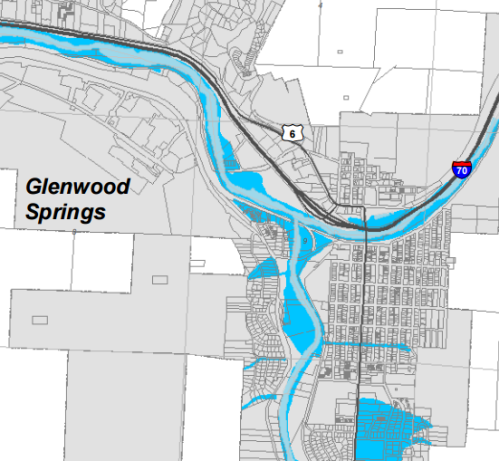
the Garfield County overlay districts map
Overlay zoning is used by communities to apply area-specific standards and/or conditions. A base zoning district (such as residential or mixed-use) determines the types of uses permitted and the minimum dimensional requirements of lots and buildings. An overlay district (or overlay zone) applies an additional layer of standards to all areas within a defined overlay boundary, regardless of the underlying base zoning district. For example, an area with single-family homes that is zoned R-1 might also be within a hillside overlay zone. In this example, the permitted uses might allow construction of a single-family home according to the R-1 standards; however, the hillside overlay zone might prevent construction without first obtaining a geo-technical report.
Overlay zoning supplements or supersedes existing regulations within an underlying base zoning district. When drafting an overlay zoning district ordinance, consider whether all overlay zoning districts shall supersede existing zoning regulations, or if certain overlay zones should be treated differently. Some overlay zones (e.g., infill and redevelopment) are drafted to permit exceptions or require a less-restrictive set of standards than otherwise provided in the zoning regulations.
For hazard mitigation purposes, overlay zoning is commonly applied to the following:
Floodplain management. Regardless of the underlying zoning in place, areas that are subject to riverine flooding require special attention. Many communities use an overlay zone to apply floodplain regulations. Properties within this overlay are often subject to additional standards concerning land uses, building elevation, stream buffers, outdoor storage, building materials, and permitting procedures.
Hillside development. Hillsides can be protected for both aesthetic and safety purposes. Hillside overlays often include additional standards to address natural features, steep slopes, viewsheds, and dangerous geologic conditions. These overlays can include provisions for special procedures, suitability analysis requirements, grading, landscaping, building height, and sometimes wildfire mitigation standards.
Wildland-urban interface. Overlay zones also can be used to identify and protect areas subject to wildfire risk.
To implement an overlay zoning district, many communities first prepare a study or report identifying a problem and linking the benefits of an overlay district to broader community policies or objectives in the comprehensive plan. Often, and particularly in the case of natural hazard mitigation, overlay zoning requires technical analysis and mapping (spatial definition) of the hazard boundary. The community then prepares the ordinance to include standards and procedures that apply to that defined overlay. As with other zoning code amendments, adoption of the ordinance requires approval by the governing body (City Council, Board of Trustees, or the County Commissioners). Overlay districts also can be amended, expanded, and lands reclassified through the rezoning process.
Douglas County adopted a Wildfire Hazard Overlay District as part of their zoning resolution. The first item listed in the purpose statement for the district is “to develop and maintain a map of Douglas County that allows for preliminary identification of Wildfire Hazard Areas.” The regulations and procedures within the overlay district not only apply to those included on the overlay map, but also any land areas field-verified as potential hazard areas. Within the overlay, land use applications must comply with general mitigation and forest management provisions, road and street design criteria, water supply provisions, and structural design elements.
In Weld County, the zoning ordinance includes a Geologic Hazard Overlay District. The district is intended to minimize hazards to people and property, especially related to geologic hazards. With assistance from the Colorado Geological Survey and the US Geological Survey, Weld County maintains a digital map delineating coverage based on previous studies related to underground coal mines (which could lead to subsidence). In this overlay, any special use permit, planned unit development, change of zoning, or subdivision of land requires a geologic hazard overlay development permit prior to approval from the Board of County Commissioners.
The primary benefit of overlay zoning is applying a unique set of standards to a specified area without having to amend all other relevant sections of the code. Other benefits include:
- Provides additional protection for defined hazard areas without negotiating on a case-by-case basis.
- Allows existing zoning regulations to be superseded or complemented to solve a known problem.
- Can implement comprehensive plan policies and strategies associated with future land use and the environment.
- Relatively easy to maintain over time following initial adoption.
Overlay zoning often requires a higher level of technical expertise to administer. For example, enforcement of a floodplain overlay requires detailed knowledge of technical FEMA and NFIP requirements and other local building and engineering requirements. Other challenges include:
- Can require trained planning and engineering staff to develop the initial maps and standards.
- Adds an additional layer of requirements to the development review process.
- To mitigate natural hazards, requires fairly technical mapping of hazard area.
- Requires a zoning amendment, which requires formal action by the governing body.
- Requires that a community have a zoning ordinance in place, which may present a challenge to some smaller communities in Colorado without zoning.
Models and Commentary
Overlay Zoning Model and Commentary
Key Facts
- Administrative Capacity: Experienced planners with city or county attorney to write regulations and more advanced technical capability to administer the overlay requirements
- Mapping: Technical mapping typically required to identify hazard areas
- Regulatory Requirements: Land use regulations with established zone districts
- Maintenance: Minimal, but adjustments may be necessary to ensure overlay districts are appropriately meeting the goals of hazard mitigation over time
- Adoption Required: Yes
- Statutory Reference: C.R.S. §31-23-301
- Associated Costs: Ordinance development or amendment costs and staff time to review rezoning applications for approved development within the overlay zone district
Additional Resources
Examples of the Tool
- Boulder County Natural Resource Protection and Floodplain Overlays Sections 4-300 and 4-400
- Chaffee County Floodplain Overlay Section 2.6.4
- Douglas County Wildfire Hazard and Floodplain Overlays Section 17, Section 18
- Garfield County Floodplain Overlay Section 3-302
- Jefferson County Floodplain, Geologic Hazard, Wildfire Hazard, and Dipping Bedrock Hazard Overlays
- City of Montrose Uncompahgre River Buffer Overlay Section 4-4-8.3
- Summit County Floodplain Overlay
- Weld County Geologic Hazard Overlay Article V, Division 2 of the zoning ordinance