
Conservation Easement
How It Works
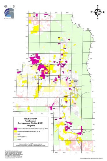
Routt County, CO. Source - Routt County
A conservation easement is a specific type of restriction placed on land to protect open spaces and sensitive resources, such as areas prone to hazards. An easement limits the ability to use or develop the land in some way, while still allowing the property owner to live on and use the land, sell it, or pass it on to her heirs. The property is legally protected, usually permanently, from certain types of uses or development that would harm the resources being protected. Conservation easements have been used widely throughout Colorado to protect a variety of resources such as riparian areas, scenic views, farm and ranch land, wildlife habitat, and historic buildings. They are a good tool for communities that have identified specific privately owned areas for natural resource protection, hazard mitigation, watershed protection, open space, parks and recreation, or other public benefit.
Conservation easements for private property can be volunteered, a regulatory requirement or sold to land trusts or governmental agencies that have a stake in preserving the property’s use through conservation. As with other real property interests, the easement is recorded in local land records and becomes part of the title for the property.
In the regulatory concept they often are used in conjunction with cluster subdivisions; for instance, Summit County requires open space tracts within a Rural Land Use Subdivision to be covered by a conservation easement or similar instrument; the associated density bonus allowed is in large part determined by the type and term of the easement.
Implementation of conservation easements requires collaboration between local governments, land trusts, and the owners of the property to be protected.
Conservation easements essentially involve private contracts, not public land use controls. Thus, in many communities land trusts lead the way in setting up conservation easements, rather than local governments. Land trusts also typically have more resources readily available to establish and monitor easements, such as staff to monitor development activity and funding for carrying out the transactions. That is not to say that local governments cannot establish their own conservation easement programs. It simply requires a higher level of capacity to do so, and it is often easier for communities to coordinate with land trusts to maintain the easements. Some steps that can be taken by local governments to implement conservation easements include: mapping high-hazard areas, then identifying and partnering with a local land trust (often by approaching an organization such as the Colorado Coalition of Land Trusts), and then approaching landowners in high-hazard areas to gauge interest in establishing easements.
In 2003 Colorado Springs coordinated with its Cedar Heights subdivision and a local land trust to protect a 295-acre park with a conservation easement to prevent any new residential development and create an open space buffer between the Pike-San Isabel National Forest and the community. The easement allowed for fire mitigation work to take place on 100 acres of the park which, in combination with defensible space around homes, was credited with helping to save the neighborhood from the 2012 Waldo Canyon Fire.
In 1996, voters in Routt County approved a property tax increase to establish conservation easements through a Purchase of Development Rights (PDR) Program. The purpose of the program was to provide funds for conserving private property from development for uses that are important to County citizens such as agriculture, recreation, and conservation uses. Citizens reaffirmed the program in 2005 and extended it until 2025.
As defined by Routt County, the PDR is a land protection tool in which a property’s development rights are purchased from willing landowners. In exchange, the landowner grants a perpetual conservation easement, or deed restriction on the property, thereby permanently protecting the land from development. The land may be sold or transferred, but the deed restriction remains in place.
Since the program’s inception, almost 40,000 acres have been protected through this program. Several of the properties that have been protected include floodplain areas that will be forever preserved from development pressures.
Larimer County instituted its conservation easement program in 1995. The Help Preserve Open Spaces Initiative has since resulted in over 8,000 acres of land protected as conservation easements. Much of the conservation easements in Larimer County exist to preserve agricultural property, though many easements protect natural areas, wildlife habitat, recreation areas, and wetlands from future development.
The conservation easement process in Larimer County is guided by the Written Project Selection Criteria that is used by county staff, the Larimer County Open Lands Advisory Board, and the Larimer County Board of County Commissioners to evaluate properties. All conservation easements are subject to a Baseline Document Report to determine the existing conditions of the property and the conservation benefit. Once established, all conservation easements within the county are monitored and conditions are reported on an annual basis.
Some of the benefits of implementing conservation easements include:
- Provides a beneficial way to preserve private lands with intrinsic public value or hazard risk without the need to acquire or further regulate.
- Provides income tax and estate tax benefits for landowners.
- Provides a relatively inexpensive way to meet community goals for open space, hazard mitigation, parks and recreation planning, etc.
Implementation of conservation easements can be cumbersome as there are many different players involved including, but not limited to, the landowner (and their families), community officials, land trust staff, realtors, and lawyers. Some conservation easements also require payment, which requires a dedicated funding source to administer. Tracking and monitoring CEs for compliance can involve staff resources. It is important to develop an adequate system for monitoring so development proposals and actions are consistent with the easements.
Hazards Addressed
Key Facts
- Administrative Capacity: More advanced administrative capacity is needed to implement and maintain conservation easements
- Mapping: Mapping of conservation areas is generally part of a local government’s mapping program
- Regulatory Requirements: N/A or jurisdictions
- Maintenance: Maintenance of the conservation lands will be required by the community, the land trust or the landowner
- Adoption Required: No
- Statutory Reference: C.R.S. §38-30.5
- Associated Costs: Primarily only staff time for local governments. Requires funding to purchase properties if administered by local government
Additional Resources
Examples of the Tool
- Boulder County Conservation Easements
- City of Colorado Springs Cedar Heights Conservation Easement
- Larimer County Conservation Easements, Landowner Conservation
- Routt County Purchase of Development Rights Board
For More Information
- Colorado Department of Regulatory Agencies
- The Nature Conservancy: Conservation Easements
- The Nature Conservancy: Conservation Easements PDF
- Keep It Colorado (Colorado Coalition of Land Trusts)
- The Trust for Public Land: A Return on Investment: The Economic Value of Colorado’s Conservation Easements
- Colorado Open Space Alliance: Colorado Open Space Programs
- Great Outdoors Colorado (GOCO)
- CWCB Stream Corridor Easements