Generally, wildfire risk is assessed through combining the following:
- Ignition probability
- Fire behavior potential
- Vulnerability of the values at risk to direct fire impingement (convective and radiant heat from the fire front) and indirect ignition (airborne embers transported ahead of the fire perimeter)
Assessment inputs include the appropriate fuel, weather, topography, and values at risk for a given area, as discussed in more detail below.
Assessing wildfire hazard and wildfire risk, including the risk of WUI fires, requires specialized expert knowledge in fire behavior, forest ecology and dynamics, and structure and infrastructure ignition vulnerability. However, land use planners and other non-specialists should work closely with experts to provide input and understand the implications of the risk assessment on local land uses.
Some communities have a dedicated wildfire mitigation specialist on staff that can provide this level of expertise. Other communities may have access to specialized expertise through the local fire authority, district forest service, academic partners, or other local organizations (e.g., nonprofit or research organizations). It is also common for communities to hire external consultants that specialize in this area.
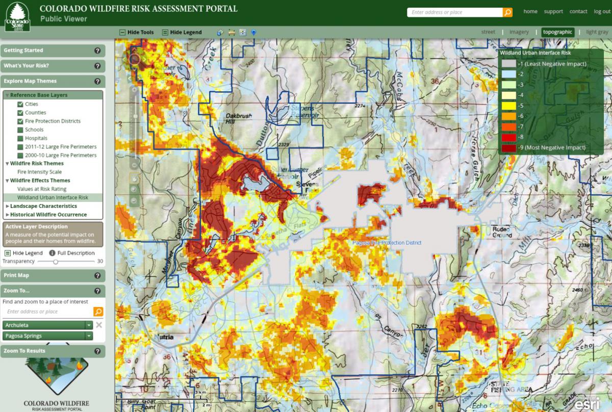
There are a number of wildfire hazard and risk assessment tools available to communities. For those communities with limited capacity or resources, the most accessible tool developed specifically for Colorado is the Colorado Wildfire Risk Viewer on the Colorado Forest Atlas Information Portal.

Colorado Wildfire. 2016. Colorado Wildfire. 2016.
In addition, there are many widely available guides to help communities develop Community Wildfire Protection Plans, such as Preparing a Community Wildfire Protection Plan: A Handbook for Wildland–Urban Interface Communities (frequently referred to as the CWPP Handbook). These (and similar publications) provide communities with concise, step-by-step approaches for developing a Community Wildfire Protection Plan (CWPP), including a hazard and risk assessment. Summit County is an example of a community that followed the CWPP Handbook guidance for the hazard and risk assessment process in the development of their CWPP. For more information on CWPPs, refer to the tool profile in the main body of the guide.
Finally, some communities elect to work with a consultant that provides a risk assessment based on their own unique proprietary tool. Eagle County, for example, used a proprietary tool that classifies the jurisdiction into “firesheds;” and Glenwood Springs approached their hazard assessment through the use of a proprietary tool that identifies wildfire hazard by evaluating a number of structure loss factors, from immediate hazards near an individual property to proximity area hazards, and then combines these with historical fire occurrence.
Many of these tools are based on models or processes that have difference assumptions, limitations, uses, and scales of use. For example, COWRAP will provide a description of the fire intensity potential based on the conditions within the general vicinity of the location defined by the user. Basic recommendations are also provided for preparedness.
All of the wildfire assessment tools face limitations regarding the accuracy of the inputs. For example, many of the tools rely on a combination of vegetation cover inventory, weather, structure, subdivision, and infrastructure/critical spatial data input. Wildland vegetation, weather and community growth, and layout can be extremely dynamic and in a constant state of change. In many cases, there can be significant challenges in keeping the data inputs that feed these tools updated in order to keep the resulting wildfire hazard and risk assessments accurate. In some cases, this lag can be measured in years. Typically, the more complex the assessment, the more difficult it is to keep up to date; however, if kept updated, the complex assessments become a very powerful tool. Finally, all of the current models are based on past and present conditions, and typically do not predict the future. For the same reasons that make keeping the assessments current a difficult task, using these tools to predict future conditions with any degree of accuracy is extremely challenging. It is important that the user of these tools have the knowledge and expertise to thoroughly understand the inputs, outputs, limitations, and assumptions of all of these tools to ensure they are used accurately and in the most effective manner.
When seeking the professional assistance and advice of a wildfire hazard and risk assessment expert, the planner should look for an individual or team that has advanced knowledge and experience in:
- Wildland fire behavior
- The application of structure ignition concepts
- Wildland fuel model identification and classification
- The assessment of forest and rangeland dynamics and health influence on fire behavior
- Field and model-based wildfire hazard and risk assessment
- The assumptions and limitations of available wildfire assessment tools
- The use and application of spatial applications for wildfire hazard and risk assessment
Non-Specialists and the Hazard Identification and Risk Assessment
Wildfire hazard identification and wildfire risk assessments require specialized expert knowledge. Non-specialists, however, play an important role in the process. For example, community planners provide necessary information to help identify community values at risk, planned areas of future growth, key demographic trends, emergency response access and evacuation routes, and other features.
As another example, a public works director can provide information on critical infrastructure and planned capital improvements. By participating in the risk assessment process, non-specialists from other departments and/or agencies contribute knowledge and can better understand how wildfire may potentially affect future community risk.
Applicable Planning Tools and Strategies
In addition to the tools and strategies cited below that are included in this guide, landscaping requirements are also important tools for reducing potential risks from wildfire. Landscaping standards often address issues such as plant material selection (e.g., requiring low-water, native vegetation) and the location of new plant materials installed as part of new development.
Addressing Hazards in Plans and Policies
- Comprehensive Plan
- Climate Plan
- Community Wildfire Protection Plan (CWPP)
- Exploratory Scenario Planning
- Hazard Mitigation Plan
- Parks and Open Space Plan
- Pre-disaster Planning
- Resilience Planning
Strengthening Incentives
Protecting Sensitive Areas
Improving Site Development Standards
Improving Buildings and Infrastructure
Enhancing Administration and Procedures
